This weekend we walked on both Saturday and Sunday with a night in our caravan at Pencarnan (above Porthsele, just south of Whitesands) with the site just reopening to visitors. A couple of glorious days walking the part of the coast path that we know and love the best, right round the St Davids peninsula.
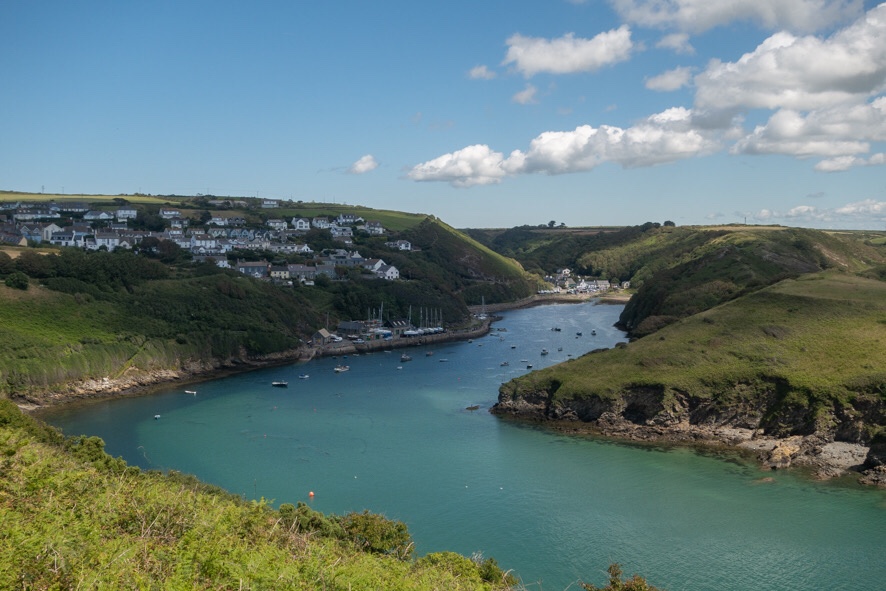
It took us a while to get going on Saturday sorting out stuff for the caravan and leaving it and one car at Pencarnan before driving on to Solva. The car park there was already busy and we passed many more groups of walkers than on the previous walk, everyone being very careful to negotiate past each other on narrow sections of path.
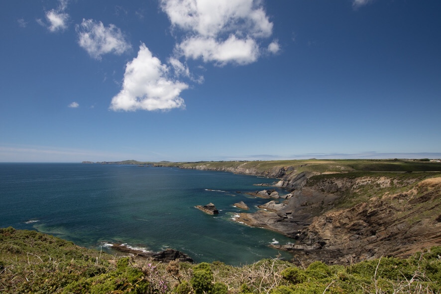
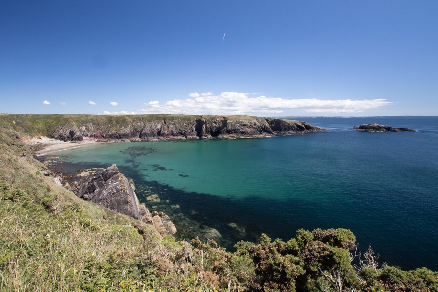
Once we’d climbed up out of the harbour to cliff top level, the path was generally wide and level so very easy walking. The tide was falling, the sea calm and blue, just a slight sea breeze to keep us cool – perfect walking conditions. It was time for lunch soon after starting, and we walked out onto one of the headlands of Porth y Rhaw Iron Age fort, much eroded but with impressive banks still visible.
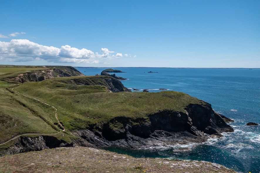
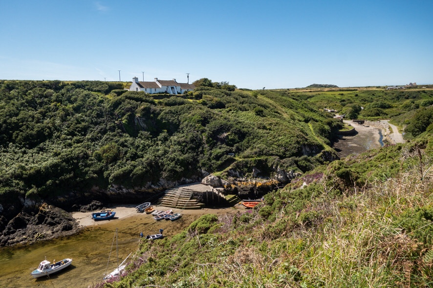
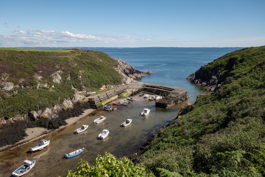
We continued west, past the cathedral stone cliffs at Caerbwdy and the beach at Caerfai, past St Nons with its chapels and choughs and fulmars, and down into the sheltered harbour at Porth Clais.
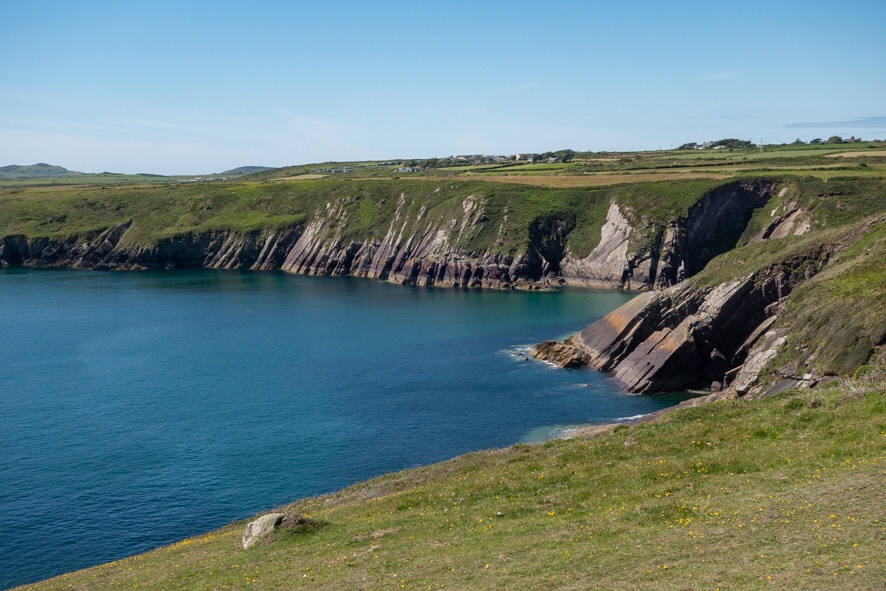
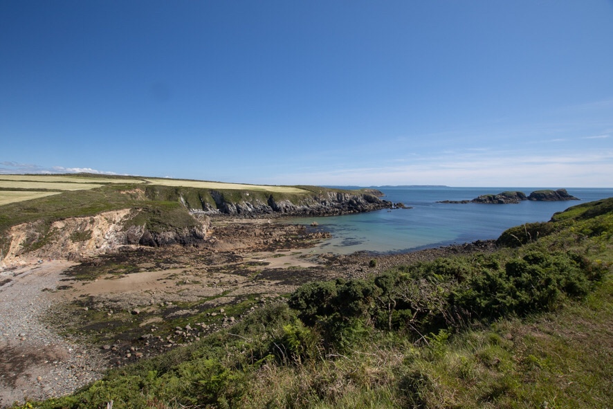
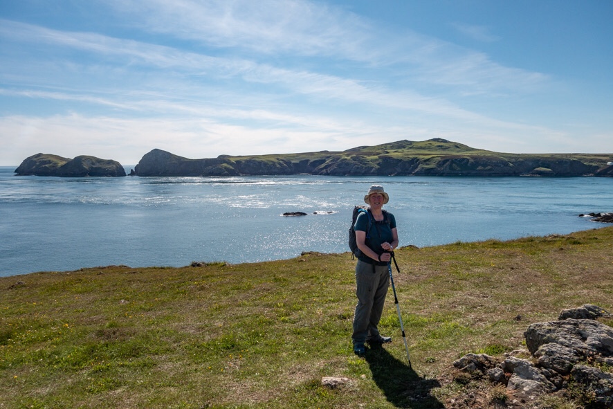
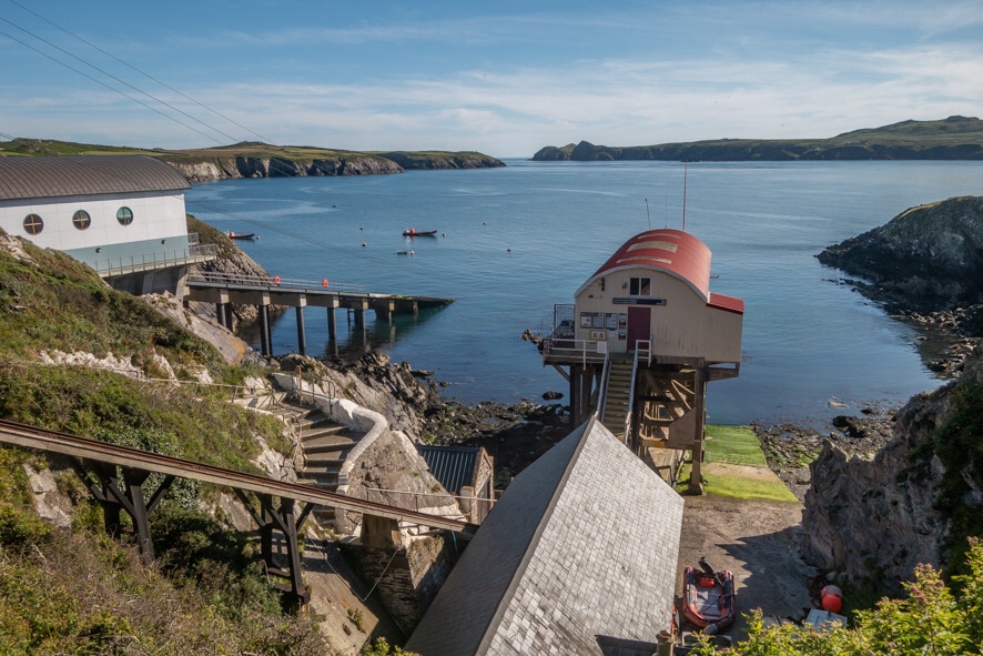
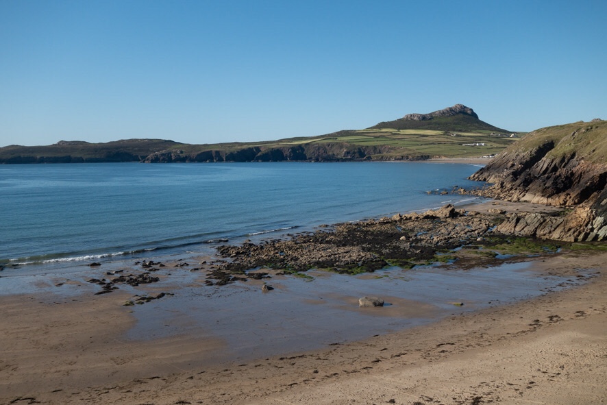
A brief stop for an ice cream from the kiosk, then on again, now looking due south across St Brides Bay to Skomer and with the jagged islets at the southern end of Ramsey Island not far ahead. We dropped down into Porthlysgi with its clear sandy bottom, then up onto the Treginnis headland. Past the heavily caved inlets where, in a couple of months, the seals will be singing, then turning our back on St Brides Bay and north alongside the troubled waters of Ramsey Sound, never still, the tide squeezed between mainland and island. Near the old copper mine at the most westernmost point of mainland Wales, a seal swam past on the current and, now late afternoon, we had the path to ourselves. Past the lifeboat station at St Justinian’s and onto the path we have walked hundreds of times, though recent cliff falls have caused it to be rerouted in places. Then a final corner turning east and the wonderful and oh so familiar view of Whitesands with Carn Llidi behind. Coming home.
12.1 miles, Sunday still to be written up…

Amazing photos even by your high standard. It must have felt extra special to be out and on home ground after all these months. I’m impressed you were out Sunday after over 12 miles on Saturday.
LikeLike