Walking the Pembrokeshire Coast Path – Broad Haven to Newgale

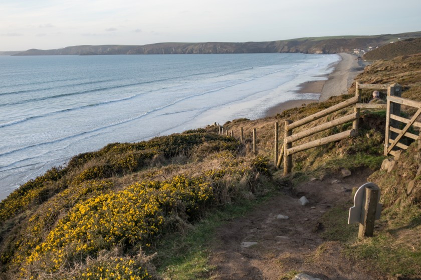
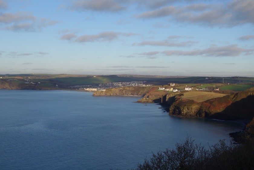
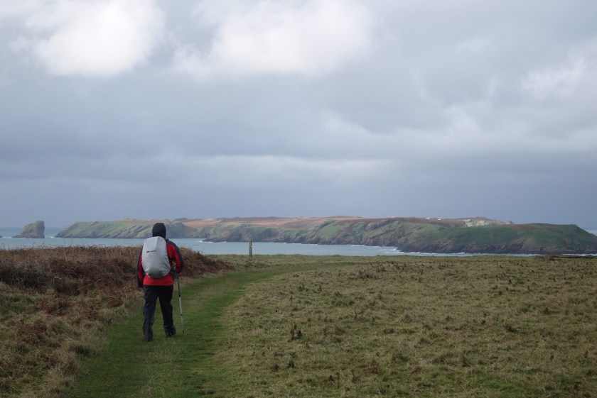
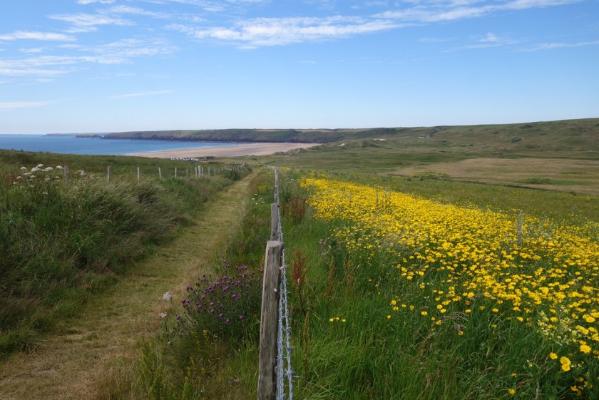
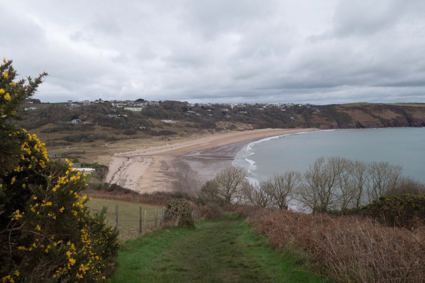
Another opportunity for a winter afternoon walk, and a Wednesday so we drove to Newgale (only 15 minutes from home) and caught the coastal bus to Broad Haven. There was warmth in the sun, releasing the plummy fragrance of the gorse flowers. It was a little hazy but calm and peaceful, just what we needed after an upsetting couple of weeks (Ian’s mum Winnie died in Scarborough Hospital last Friday).

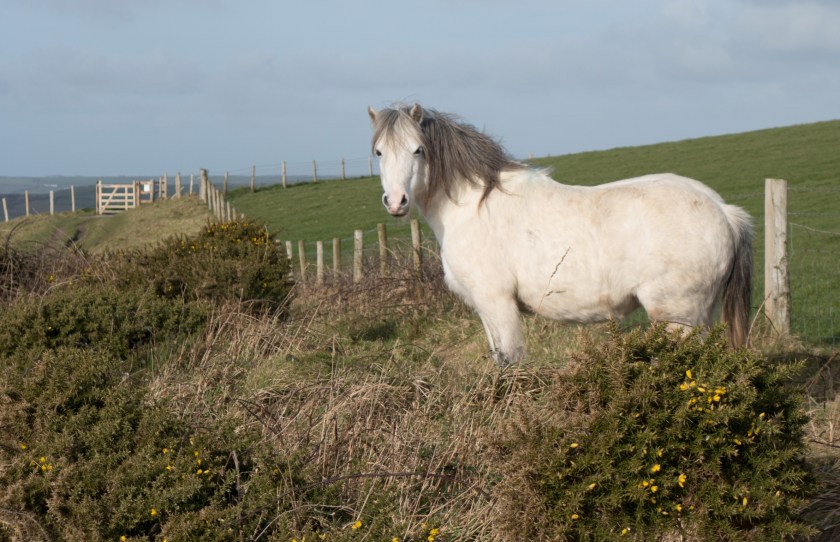
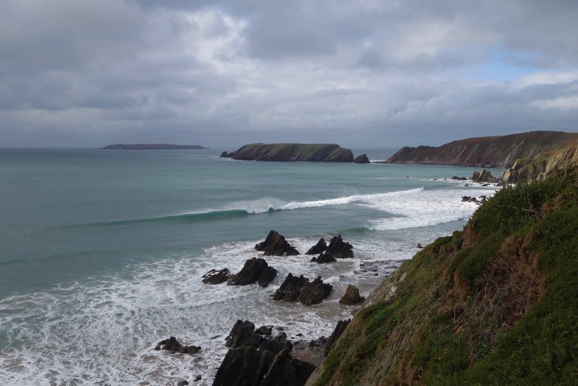
The path climbed out of Broad Haven then headed more or less due north along the inner sweep of St Brides Bay. The land continues to erode with great chunks slumping down towards the sea. We met ponies (they help keep the undergrowth down) at Haroldston Chins, and saw one of the resident pair of peregrine falcons.

Pony on the path
Haroldston Chins

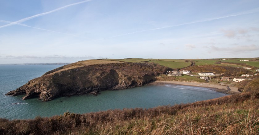
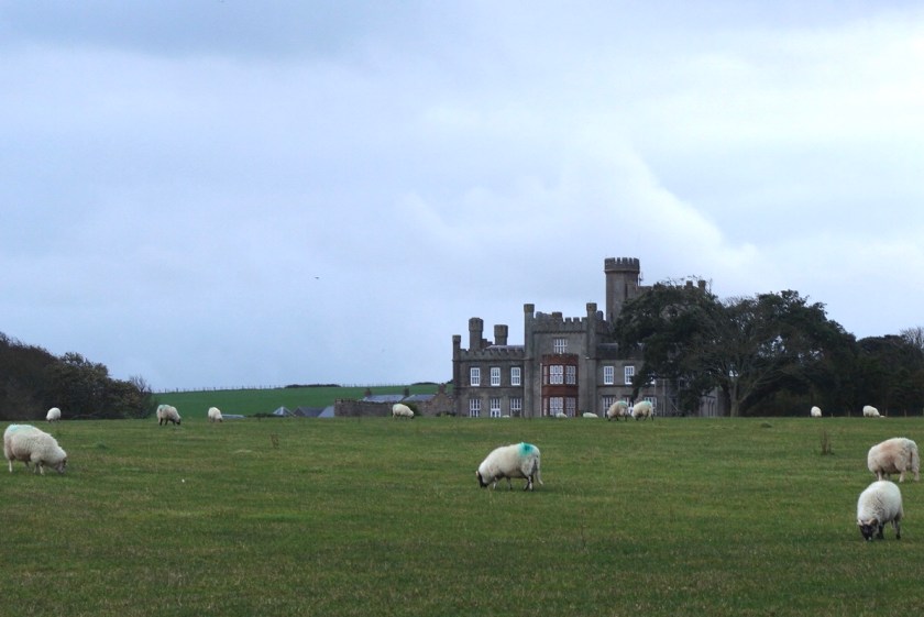
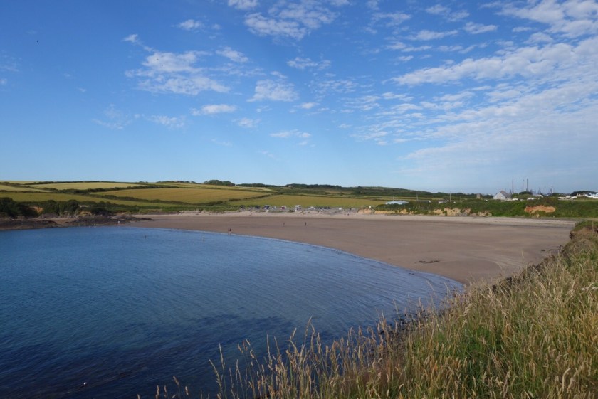
At Druidstone we had to skirt inland round the Druidstone Hotel, with good views of the modern ‘Tellytubbies’ house beyond. The beach is lovely but the tide was high – we will return at low tide and explore, and see if the hotel is less eccentric than on previous visits. We sat on a rock and enjoyed tea and a gorgeous pork pie brought all the way from Yorkshire.

The Tellytubbies House

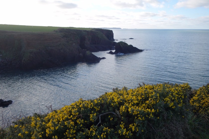
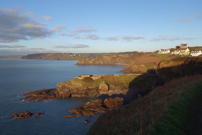
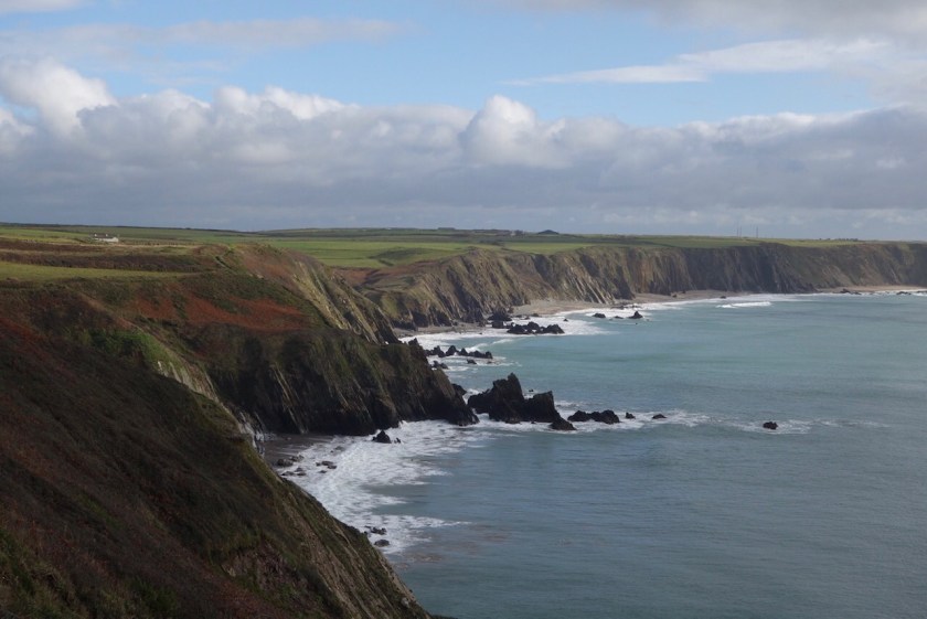
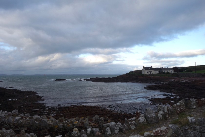
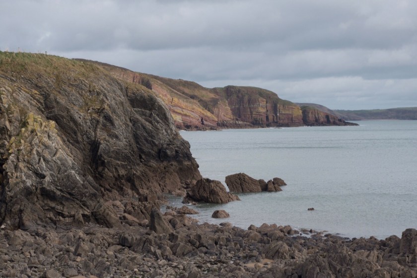
Back up to the top of the cliff and on to Nolton Haven, a pretty little inlet facing south-west. We didn’t linger but continued northwards, with Rickets Head dominating the view. We were back onto the coal seam, the path dark grey and gritty. Apparently the unusual shape of the head is a result of coal having been mined from the shoulder. We had a steep climb up Black Cliff, then the path continued to swoop and soar past an old colliery and on towards Newgale, a couple of miles of sand backed at the northern end by a steep shingle bank.

Nolton Haven
Rickets Head
Approaching Newgale

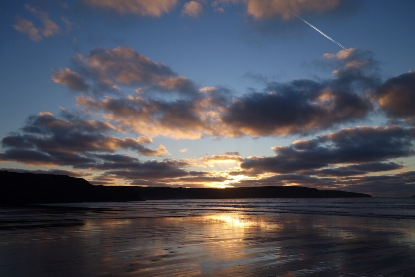
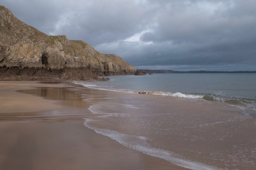
We got down on to the sand as soon as we could, with the tide retreating, and walked the last mile or so under a beautiful sky – a nearly full moon shining brightly, lots of criss-crossing con trails, the sun slowly sinking towards the sea with a little rainbow each side – Wikipedia tells me it was a sun dog. We finished with a quick drink in the pub where we’d parked, hoping for a spectacular sunset but that too was gentle and faded away quietly. RIP Winnie.

Late afternoon surfers
North end of Newgale

6.9 miles in all.

Walking the Pembrokeshire Coast Path – St Brides to Broad Haven

After what felt like months of rain and gales it was a relief to have a couple of sunny days and, in spite of many commitments both at home and away, we managed to fit in an afternoon walk on Monday. For the first time we used two cars, which I’ve tried to avoid, but with the coastal bus only running on Wednesdays there was really no alternative.

As we drove in convoy through freezing fog I thought we might have made a big mistake, but it was clear and beautiful on the coast, with little wind, though not much above freezing point out of the sun.

St Brides Haven looked much more cheerful than when we finished there in November. The path was muddy but straightforward with no big climbs or drops. As we ate a late lunch we watched a little boat checking lobster pots. There were also several tankers at anchor in the bay, as usual.

St Brides in sunshine
Vessels large and small
Gorse in full bloom

It wasn’t long before we could see Broad Haven ahead, though Little Haven (which we would reach first) is much more hidden. We passed through one of the few wooded parts of the path – although it’s north-facing, this corner of St Brides Bay is the most sheltered. Then a brief bit of road, then back between cliffs and fields (though it was tempting to stay on the road which takes a much more direct route). Finally down some steps to the Point at Little Haven and the Swan Inn – shut until next week but as we are having a dry January this wasn’t a great disappointment.

View through the trees
Broad Haven in the distance
Approaching Little Haven

If the tide is right out you can walk along the beach to Broad Haven, but it wasn’t, so we had a final half mile up the very steep road and down the other side, reaching Broad Haven a few minutes before the sun set. A glorious end to a good walk, only 6.6 miles but it was satisfying to get going again.

Reflections on Broad Haven
Sunset with con trail

Walking the Pembrokeshire Coast Path – Dale to St Brides

Firstly many thanks to everyone who has sponsored us, very much appreciated. Still not too late…

October whizzed past with no opportunity for a long walk, but the forecast for Tuesday looked reasonable so we headed south-west again and parked the car at Marloes. There was little sign of the promised sunny intervals and we got cold and wet waiting for the bus to take us a couple of miles back to the start of the walk at West Dale. The ground was very wet underfoot but in general the path was good, with springy turf and not many ups and downs. The sun broke through from time to time, though rarely overhead, but giving changing light on cliffs and sea.

West Dale bay
Marloes Sands, Gateholm and Skokholm

The gorse is just starting to come back into bloom, and there was a great variety of fungi. Choughs were enjoying the strong wind, a peregrine swept past and we saw a raven bring down a black-backed gull in a squabble over a dead sheep.

Looking back

The tide was high so there wasn’t much sand at Marloes Sands, but we’ll return and explore it another day. We continued past Gateholm and on to the Deer Park which reaches out towards Skomer. The coast path cuts off the headland but it seemed a shame not to do it properly so I persuaded Ian to walk round the edges. We were rewarded by seeing a couple of end-of-season seal pups, the first during our Coast Path walk. There will be lots more seals once we’re further north. Having turned the corner we now had the whole huge sweep of St Brides Bay ahead of us; Ramsey Island only 10 or so miles away as the crow flies, but still 30 miles on foot. But it feels as if we are reaching familiar territory.

Approaching the Deer Park and Skomer

The facilities at Martins Haven were all shut until March. We walked on looking for a good lunch spot but the walk changed completely at this point from being easy to pretty unpleasant. I knew the strong northerly wind would be a factor but hadn’t realised that the path would be much narrower and very muddy. Rain squalls were drifting across St Brides Bay towards us. We slithered on east and then north, resisting the temptation to take the shortcut back to the car at Musselwick, and finally reached the little inlet of St Brides Haven with its improbable castle.

Musselwick
St Brides Castle
St Brides Haven

That was the end of the coast path (10 miles) but we had 2 more miles of soggy fields and tracks, uphill all the way, back to the car. The walk was finished off not with a welcome pint and pub meal but with a trip round Homebase. Winter is here!

Walking the Pembrokeshire Coast Path – Milford Haven to Dale

After a busy few weeks of visitors, buses and tides coincided on Monday to allow us to walk the next section. It was drizzling when we parked in Dale but improved slightly by the time we got off the bus in Milford Haven. The first two or three miles were pretty dull walking, first through the town and then along a tarmac path between the shore and yet another refinery, with high hedges and no views, but then the tarmac ended and we could see cliffs and hear the waves – after several days walking around the Haven, we were getting closer to the real coast again.

Misty Milford Haven

Although we could see Dale across the water a few miles ahead, there were several big inlets to tackle. Sandy Haven was a much bigger beach than I’d expected and we decided to walk along it. Unfortunately this meant crossing some slippery rocks and Ian ended up shin-deep in a rock pool with a scraped elbow and hurt pride.

Squelching across Sandy Haven
Sleeping Bay

It was almost low tide so there was no problem crossing the stream at Sandy Haven (at high tide there is a 3.5 mile detour), and we continued round past Lindsway Bay and up the inlet opposite Dale, where a notice warned us that the Pickleridge footbridge across the channel had been washed away and could only be crossed, at very low tide, by wading. The alternative was another long diversion so, since Ian had already got damp boots, we decided to risk it and yomped along the pebbly foreshore to get there while the tide was still low. In the event it was more of a paddle than a wade with just a small section missing.

Red cliffs and blackberries
Missing link at Pickleridge

When we reached Dale we had done about 11 miles and after coffee and cake at the pub, we decided to walk the circuit round St Anne’s Head – I’d mentioned this to Ian as a possibility and he looked at the map and decided it wasn’t too far. I had my suspicions it was further than it looked, but off we went again, now with sunshine and glorious views but also with a deadline of 6.30 when we were due back at the Griffin Inn for a meal.

Blue sea at last
Interesting place name!

It took well over half the time to reach the lighthouse at the southern end of the head, but the walk up the western side was much more straightforward, and at last we had proper sea and cliffs and distant islands, but chill air and fading light reminding us that summer is just about over. 17 miles of coast path (phew!) and just half a mile or so back into Dale for a very well-deserved meal.

Looking out to Skokholm

And finally a request – we have joined the Families for Children Adoption Trust’s Miles for Smiles campaign. Families for Children finds loving and supporting adoptive families for the most vulnerable and hardest to place children – including sibling groups, older children and those with complex additional needs. The charity places children from all around the country into secure homes in the South West of England, and then provides Adoption Support Services that help families unite to achieve positive change that will last a lifetime.

We have an indirect vested interest since our daughter Corinna works for the charity, but we know how hard it is for them to get the funding they need. Any donation you feel able to be make would be very much appreciated.

Please make a donation

Walking the Pembrokeshire Coast Path – Pembroke to Milford Haven

Some days I put on my walking boots and feel as if I could keep walking for ever. Friday was not one of those days, Ian had to lead all the way, and it has taken me several days to get round to writing the blog.

We caught the bus to Pembroke from outside Milford Haven Tesco’s – it didn’t feel like somewhere to want to get back to at the end of the day. The bus dipped and dived around the Haven, taking an hour to cover a 20 min car journey. We were glad to finally start walking, soon leaving the town and castle behind us and heading mostly through woods up and along the ridge between Pembroke and Pembroke Dock.

Looking over Pembroke Dock to Neyland
Pembroke Dock barracks

Over 260 Royal Navy ships were built at Pembroke Dock between 1816 and 1922, and a few historic buildings remain. We passed the barracks above the town, and a Martello Tower at the water’s edge. Then we climbed up the hill through uninspired modern housing and out onto the Cleddau Bridge, completed in 1975. Half a mile to the far side, high over the Haven, and then a further mile or so alongside the main road until we’d crossed Neyland Pill as well. It was a relief to get away from the road noise and heat, back into woods until we reached the shore at Neyland – developed by Brunel as the Great Western trans-Atlantic terminus, but now quiet in the afternoon sun. And now heading back downstream!

Looking downstream from the Cleddau bridge
Looking back to the bridge
Across the Haven to Pembroke Dock
Tranquillity at Llanstadwell

Continuing along the foreshore road past Llanstadwell church, I was very pleased to find an unexpected pub at Hazelbeach for a cold ginger beer and a chance to rest tired feet. Then back onto footpaths, but soon we had high wire fences and some over-zealous weedkiller use as we skirted around the Liquified Natural Gas plant. The refinery that we passed on the previous walk was in action again and the sound carried over the water.

The path turned inland and joined a B road, somewhat busy and badly littered. The last couple of miles into Milford Haven were a bit of a slog and by the time we reached the car I had had enough – straight home for a bath, and fish and chips from our local takeaway. 12.3 miles of coast path, not as unpleasant as I have made it out to be though sadly lacking any sight of the sea, and I hope my energy returns!

Walking the Pembrokeshire Coast Path – Angle to Pembroke

We were glad to get away from home for another day’s walking as the field opposite the house is full of mournfully bleating ewes who have just been separated from their lambs – the noise is incessant! So yesterday we drove down to Pembroke and caught the lunchtime bus to Angle.

We’d never walked this section, eastward along the southern side of the Haven, and as there is a major oil refinery and power station, I had assumed it would be mostly an industrial landscape. I was surprised and pleased to find lovely paths and quiet roads along the foreshore, ferny woods with glimpses of the water, and tracks across fields with cattle, sheep and ponies too drowsy in the heat to show much interest in us.

Egrets on the foreshore, old farmhouse in front of the refinery
Ferry on its way to Rosslare
Not very industrial

For a couple of miles we were accompanied by the roar of flare stacks burning off excess gas; this was unpleasantly loud and the air was tainted with oil, so not a place to linger. Apart from that, the only negative was lots of biting flies throughout the walk, undeterred (I suspect attracted) by insect repellant, which have left their mark on me.

Under an unloading jetty
The flare stacks were just behind us. Sheep unconcerned
Pwllcrochan Church. Not as peaceful as it looks.

We could see Pembroke Castle in the distance from many points during the walk, and were glad to reach it just before 7pm, after 11.9 miles. Perfect timing for another pub supper on a terrace overlooking the Mill Pond.

Pembroke Castle

Walking the Pembrokeshire Coast Path – Merrion to Angle

Oh dear – where has 2019 gone? It’s over 5 months since we last managed a coast path walk, at this rate we will never finish it. It’s actually much easier to do a long-distance walk in one go as you schedule the time for it and do it regardless of weather and other distractions.

Bus schedules meant that this had to be an afternoon/evening walk, not a problem at this time of year. We called in at the Freshwater West beach cafe before we started, and shared a delicious lobster roll (no way was I paying for 2 of them!). Then we parked at Angle and caught the bus back to the point where we finished last time (actually 100m up the road – shh don’t tell anyone we missed a bit).

The first 4 miles were across fields around the northern edge of the firing range, with occasional whumps and rat-a-tats in the distance. Then we walked down to Freshwater West, revisiting the cafe for drinks and fantastic ginger cake. The tide was right out but the beach wasn’t busy, it’s one of the best surfing beaches but the sea was far too calm.

Freshwater West

I hadn’t ever walked the path round to West Angle, only 5 miles or so, but lots of very steep downs and ups, and a warning notice about it being a challenging section. The path was more overgrown than elsewhere, being less used, but there were some lovely summer flowers.

West Angle Bay

We were flagging a bit by the end of the stretch, but after eating our emergency Snickers we decided to carry on around the coast to Angle rather than taking the shortcut up the road. We were now walking along the southern side of Milford Haven (referred to locally as the Haven, to distinguish it from the town of the same name), the huge waterway that almost cuts Pembrokeshire in two. It’s the third biggest port in the UK according to Wikipedia, but at 7pm there was no traffic.

The Haven and Stack Fort Rock

We were pleased to reach The Old Point House, an atmospheric pub on the waterside. After a slightly odd meal (pie, chips and pink coleslaw tasting of orange) and a refreshing pint we walked the last half mile back to the car in lovely evening light. 12.5 miles and about 800ft up and down.

Angle

Walking the Pembrokeshire Coast Path – Broad Haven South to Merrion

A sunny day was forecast after the snow (which missed most of Pembrokeshire anyway) so we set off to walk the next section of the path. I’d decided to do this as a circular walk so we weren’t dependent on the twice-a-week bus, but then found that the path was only accessible at weekends – this section is all within the Castlemartin firing range. With a bit more organisation we could have made use of the Saturday bus and we wouldn’t be feeling so tired tonight.

We parked at Bosherston and walked down by the lily ponds to Broad Haven, where we finished last time. It still gets me every time – the transition from the calm lake in a secluded valley to the beach and open sea, just a few metres apart.

Bosherston Lily Pond
Church Rock off Broad Haven South

We pootled along taking photos, with a diversion to St Govan’s Head (the most southerly point in Pembrokeshire) and down to St Govan’s Chapel, wedged into a cleft in the limestone, then found a bit of shelter from the strong wind to eat our sandwiches.

Looking west from St Govan’s Head

St Govan’s Chapel

At that point I looked at the map and realised we had made very little progress westwards. When I suggested to Ian that we might only have done a quarter of the walk he was somewhat horrified that it might be a 14 miler, so I revised it down a bit. We then walked rather faster. It was very easy walking (apart from the fierce headwind), very level with gravel tracks across the firing range and signs telling us not to pick anything up as it might kill us. It was black bird day – choughs, jackdaws, ravens and cormorants.

Before too long we reached Stack Rocks and the Green Bridge of Wales, a natural arch which I’d never visited before. A big chunk of it fell off last winter so catch it while you can! At this point the path heads north inland, the south-western corner can only be visited on an accompanied tour so that will wait for another day.

Green Bridge of Wales
Flimston

The road north was longer than I’d anticipated, but after passing the ruins of Flimston Farm and church we reached the junction near Merrion and turned east, to head back to Bosherston along the alternative route (for when the range is closed), pleasant enough across mostly empty fields. 12.1 miles in all, 7.3 coast path, and we’re both pretty tired and wondering if we are particularly unfit at the moment or just getting too old for this. I think we need more practice!

Walking the Pembrokeshire Coast Path – Freshwater East to Broad Haven South

After a three month break, it is time to get going again, though as we are both carrying a bit of Christmas excess I took notice of the complaints from my co-walker about the length of the walks and made it a bit shorter this time. The small coastal buses only run on Thursdays and Saturdays in the winter, so we seized upon a Saturday with a reasonable weather forecast and drove to the far end of the county, cutting it rather fine as Ian was still putting his boots on when the bus arrived. A bumpy 30 minutes later and we were back at Freshwater East, no longer in autumn sunshine but under lowering cloud with a strongish westerly wind. It was dry and not particularly cold though, not bad at all for January.

There were a few ups and downs on the first section, but not too challenging. Looking back from Stackpole Quay, we could see the wonderful rock layers that we had been walking over.

The cafe at Stackpole was closed for the winter so we carried on to Barafundle to eat our sandwiches. Barafundle was named as one of the best beaches in the world and now gets too many visitors in summer, but it was ok today.

Beyond Barafundle the geology and landscape changes – almost level turf, nibbled by sheep, with sudden slumps where a cave has collapsed way below. Easy walking until we clambered down rocks onto Broad Haven, then a tough few minutes up through soft deep sand back to the car. 6.5 miles, not very impressive.

Walking the Pembrokeshire Coast Path – Penally to Freshwater East

We decided to do the next stretch before Storm Callum arrives, so yesterday we drove down to Freshwater East, walked a mile back to the main road and caught the bus to Penally. It was sunny but with a very blustery wind from the south-east, and hazy too so no distant views – and I’m pleasantly surprised that there were a few reasonable photos.

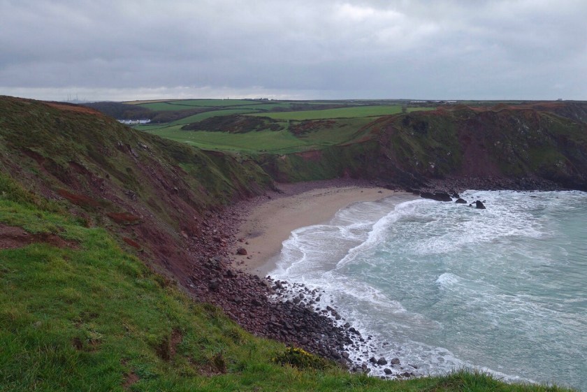
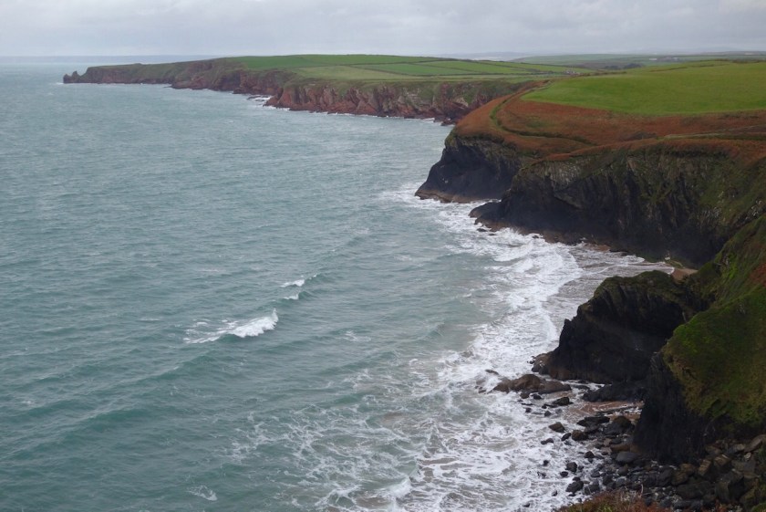
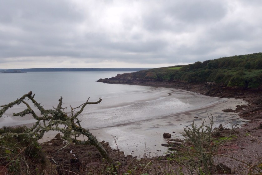
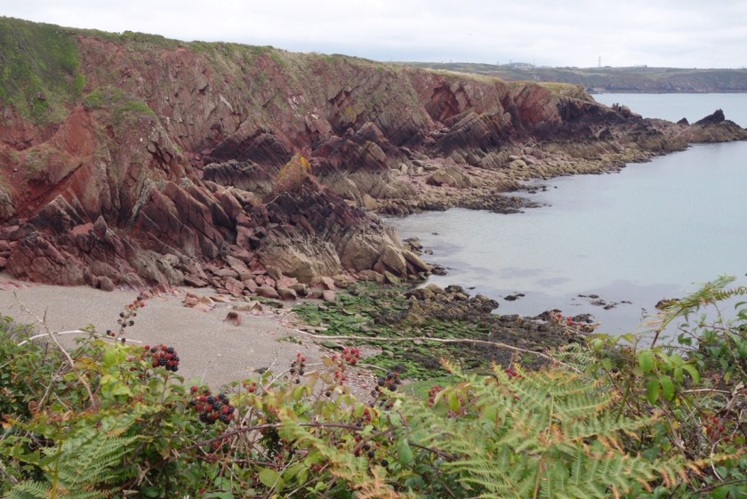
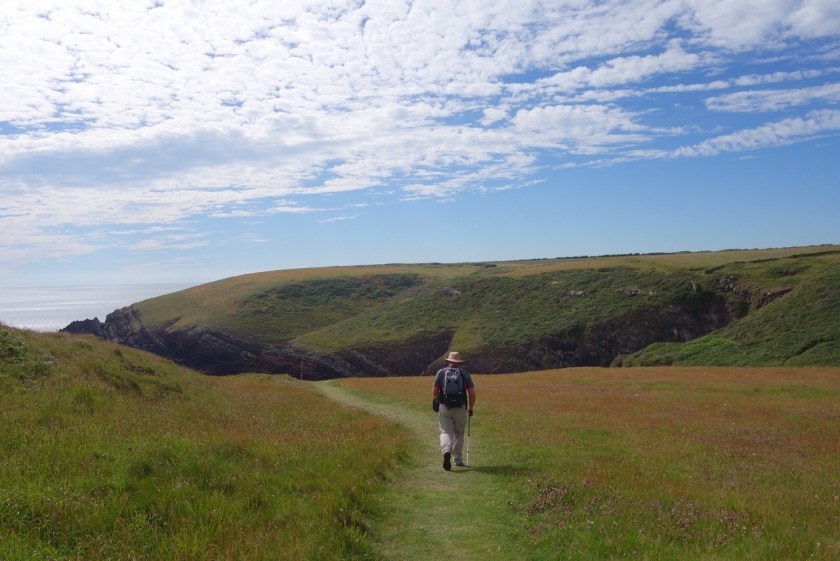
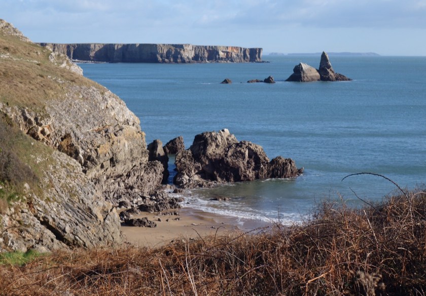
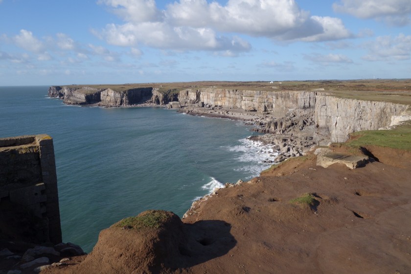
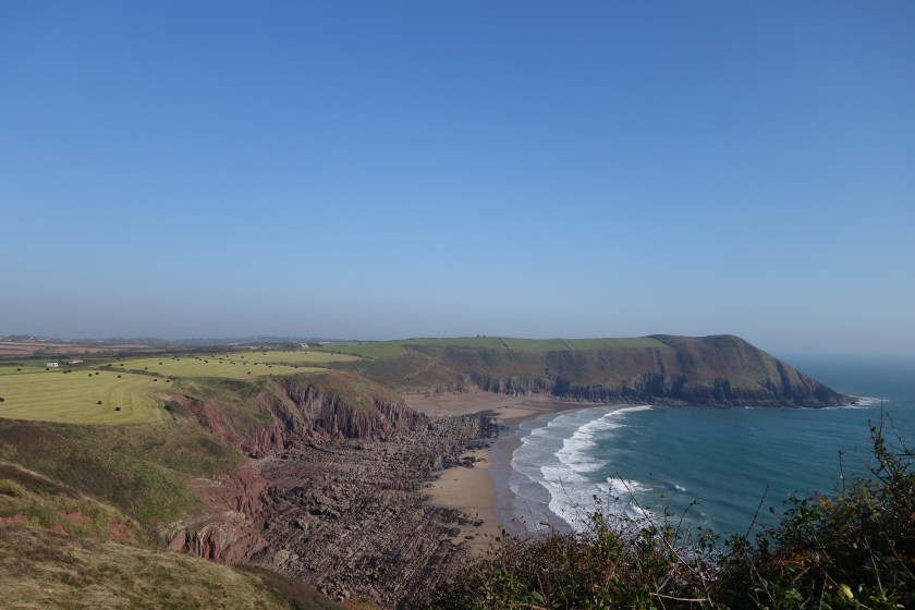
This stretch of the path was completely new to me, and we were so fortunate to be walking at low tide as there are several stunning beaches, mostly difficult to access though. The first, Lydstep, was rather marred by densely-packed caravans and must be really busy in the summer. It was slightly damp underfoot and a combination of slippery rocks, mud and leaves made the going treacherous at times. Beyond that, Skrinkle Haven, then behind the Manorbier firing range to Presipe Bay.

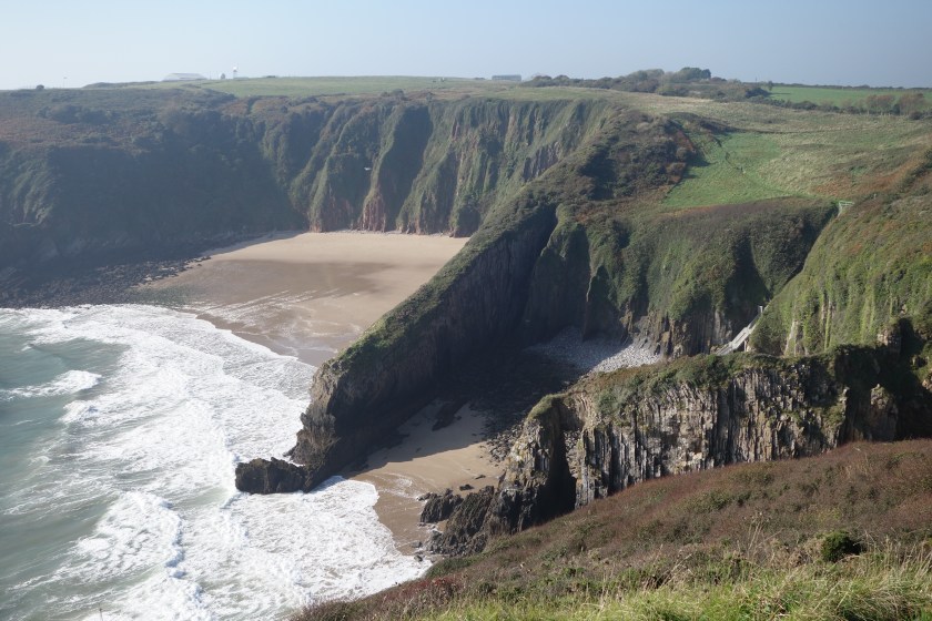
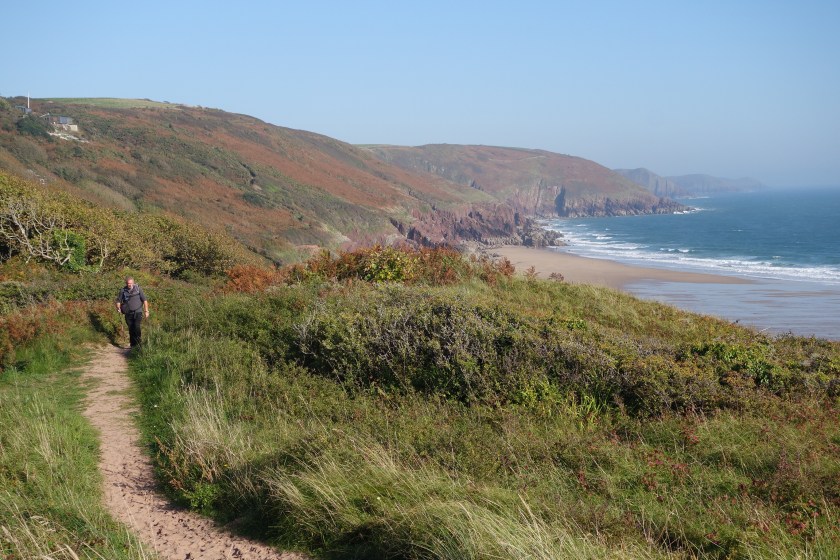
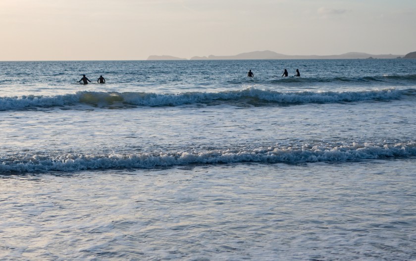
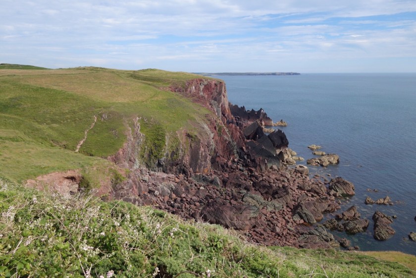
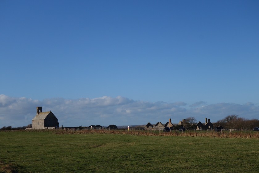
Then the path contoured along a relatively gently sloping cliff to Manorbier, where we ate our sandwiches on the beach, though we were a few welsh cakes short of a proper picnic. Readers of a certain age may recognise the castle as Cair Paravel in the BBC Narnia adaptation. After this, the path roller-coastered along, past Swanlake Bay with a solitary swimmer and finally down to Freshwater East. We followed the path through the sand dunes, where a few burnet roses were flowering, then looped back onto the beach with the wind now in our faces and up a very steep wooded path to the car. 8.6 miles of coast path. I wonder how many more sunny opportunities we’ll have?