Day 11: Gilwern to Llangynidr

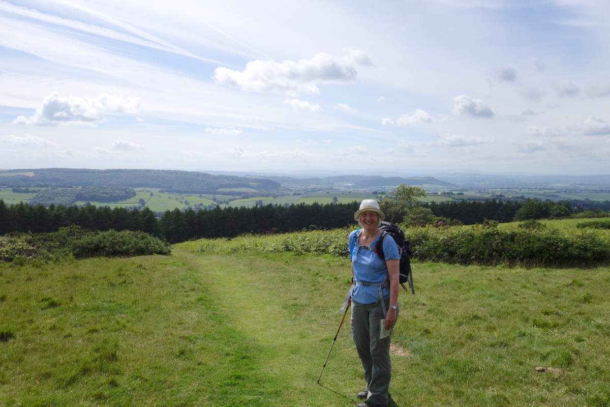
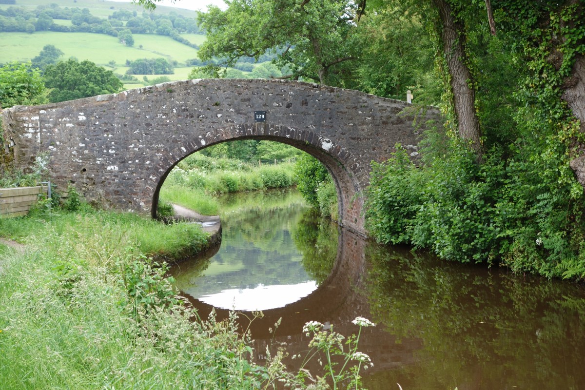
Today’s walk was short by our standards, just under 9 miles, and exceptionally easy following the canal from Gilwern to Llangynidr – completely level as there are no locks and the canal meanders along the contour line. But we are both very weary in spite of having slept well, and looking forward to our rest day on Thursday.

The official Usk Valley Walk left the canal for a couple of miles, up a hill and back down again, which would have provided some variety, but we were content to plod along on the level. In some ways the shorter days are more mentally challenging as you spend a lot of time thinking it must soon be finishing. The long days you set out without any expectation of getting to the end.

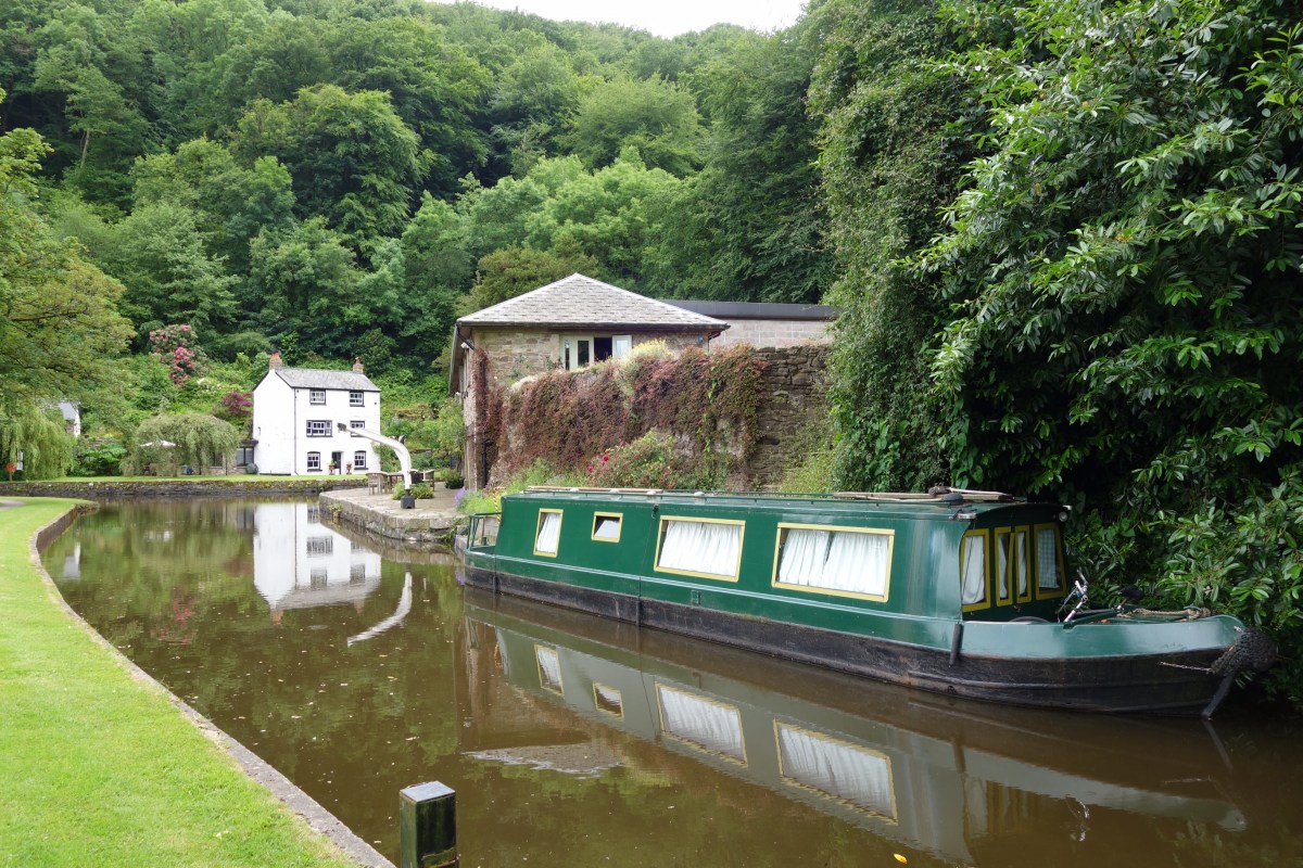
A few things permeated through the general weariness – a heron in a tree, a big redwood, some lovely yellow iris, distant views of hills for another day. There were a few narrowboats moving today; we were moving faster but needed to stop more frequently so it was tortoise and hare. They were slightly smellier than us.

I’m now sitting in the lovely garden of Helen’s charming B&B, listening to the river Usk in the valley just below, and the sun has come out briefly – little sign so far of the sunny weather forecast a few days ago.

Day 10: Clytha to Gilwern

Last night’s barbecue in the pub garden was delicious, though the locals seemed a bit bemused (we would have eaten in, but no food served Sunday evening so we had to improvise). A full Welsh breakfast this morning included laverbread (seaweed) and cockles, which I’m not convinced is better than the English experience, but definitely better than the full American with beans and hash browns – yuck.

Having said goodbye to Charles and Zoe, and settled their bar bill, we headed for the river to pick up the Usk Valley Walk, which will take us to Brecon. It was a peaceful morning, partly cloudy with the headwind catching us at times, swallows skimming across the fast-flowing river, a couple of herons. The path was generally good with only a few bramble tripwires, lethal nettles and one field of stampeding cattle to contend with. But we’re getting used to all that.

A hiatus at lunchtime where we had to cross the Usk on an extremely narrow bridge shared with a very busy A road, which was not nice. Immediately afterwards I caught my leg on a fallen branch and ripped my shin. Ian was already feeling under the weather but he recovered enough to buy me some chocolate and we found a bench in a quiet churchyard to eat our sandwiches and apply a plaster.

Then the path went straight up to the 110m contour line and stayed there for the rest of the day, on the towpath of the Monmouthshire and Brecon canal halfway up the hillside. Deserted at first, punctuated by little bridges leading nowhere, but gradually getting busier as we skirted above Abergavenny.

We are now in Gilwern, which I was worried about as we drove past a couple of weeks ago and it is a tangle of A roads and roadworks, but the canal keeps to its own place and pace and brought us to the heart of the village and the friendly Beaufort Arms.

12.6 miles, and we have walked further than the planned remaining mileage, but I hesitate to say we are halfway as the estimates have been consistently low.

Day 9: Monmouth to Clytha

A shorter day thank goodness, 12.5 miles and not much over our estimate. We’re in a huge room in a quirky pub with a four-poster bed, of which we are making good use (the travel washing line is one of my favourite gadgets).

We were slow getting started this morning, having had a lovely evening with cousins Patrick, Maggie, Emily and Chloe – good company and good food. Packing took ages as everything that could be unpacked or detached from something else, had been. Nothing to do with the G&T or wine last night of course!

For the first half of the walk we were on Offa’s Dyke Path which was fully signed and really easy to follow, so the path carried us along instead of us having to stop and argue at every junction. There was a short section through woodland, mostly uphill, but yesterday’s horrible insects were having a Sunday morning lie-in.

I’d hoped for some good views but once again the trees or more hills got in the way, and it was only after we left the path, and started descending down into the Usk Valley on country lanes, that we started to get glimpses of the Brecon Beacons ahead of us. The lanes were almost deserted apart from a large bus, only slightly narrower than the road, with two people on board heading back to Monmouth.

Tonight we have daughter Zoe and her husband Charles with us, and they are barbecuing our dinner as the pub doesn’t do food on Sunday evenings – time for me to wrap this up, wrap up warm and join them!

Day 8: Mitcheldean to Monmouth

Sam and Dave, this is what your feet might look like after 110 miles and a few extra years.

Another day where the estimate was way under – we have walked 18.5 miles and are pretty tired. It was Ian’s turn to flag today, last night’s chicken salad and today’s yoghurt and croissant breakfast not sufficient to keep him fuelled. We had sandwiches and chewy bars for lunch, but didn’t find anywhere for a sweet treat to help us along.

Leaving Mitcheldean, we immediately had to climb up a long steep hill, more tiring than usual with full water carriers. At the top there were some strange Easter Island style carved stones,  we didn’t get close enough to discover why they were there.

Most of the walking was through the Forest of Dean – pleasant in parts, and easier underfoot than yesterday most of the time, apart from some mud, but we were plagued this afternoon by horrible little black flies that wanted to go in our eyes and noses. It was difficult to get much idea of progress as one bit of forest is much like another. Ian saw a deer, and we think we saw a couple of wild boar.

At the end of the afternoon the path climbed to to top of Kymin (250m) but we opted out this time and went round the side, still a long drop down into Monmouth. We crossed the Wye, and we are now in Wales! Goodbye Wysis Way and the dodgy mileages, hello Offa’s Dyke Path (just for tomorrow).

Now bathed and changed into the one set of ‘evening’ clothes, and off to have dinner with my cousin Patrick.

Thank you all for the comments and encouragement, we are really appreciating it.


Day 7: Gloucester to Mitcheldean

We knew today was going to be challenging so made a reasonably early start after a rather weird DIY breakfast of instant coffee, oaty smoothie and egg sandwich. Once we found our way out of Gloucester Quays, we followed quiet cycle paths out to the north-west, crossing two channels of the Severn. We crossed the A40 by the lovely Over Farm Shop, where we bought two delicious pies.

I found it a bit hard to get going today, the initial euphoria has worn off, but cheered myself up by thinking that Theresa May was having a worse morning.

The paths were good for a while, mostly flat and fairly easy to follow, but as the morning progressed the going got harder, with many stiles hidden in nettles and brambles, and arable fields with no obvious route across. At one point we were on a disused railway line, which led us clearly into a field full of cattle who were interested to see us. Having skirted around them, we weren’t best pleased when we found there was no way out of the field at the far end, so had to backtrack several hundred yards to find an unmarked stile high up in the hedge bank.

We finally reached the pub where we had originally intended to have lunch at 2:30, after 12 miles. Thank goodness we’d had the pies! A ginger beer and KitKat gave us some instant energy to climb May Hill which had been lurking on the horizon for most of the day. We did get right to the top (just under 300m) but there were no views to the east because of trees – so no looking back! Plenty of hills to be seen to the west, and before our walk was finished we had descended and climbed over two more ridges, the last climb through another field of not-all-cows, some with horns, who thought about pursuing us but didn’t seem to fancy the slope any more than I did.

Our second Airbnb tonight, very comfortable and friendly, and we have our own kitchenette, so have eaten in for a change – glad not to have to go back out after 17.5 miles and another long one tomorrow.

Day 6: Upton St Leonards to Gloucester

Today was an intentionally short walk (5.7 miles) so we can have a bit of a rest. Not a nice day for walking; we left the hotel as the rain started, looking happier than the tour party whose coach had broken down.

The Wysis Way again wasn’t easy to find or follow, which is slowing us down considerably. After we’d crossed the M5, Ian went into giant-killing mode against some enormous brambles while I cowered behind, trying to avoid both the stick and the rebounding stems. We should have gone right to the top of Robinswood Hill on the way into Gloucester but we kept getting lost and, as there was not much chance of a view, we eventually stuck to paths on the flank – still steep enough for Ian to slip and sledge a little way down the hill on his waterproofs.

It was a rather boring couple of miles to the city centre and the Travelodge, where we were too early to check in so left our bags and boots and went for a wander. The Quays have been redeveloped but the area around the Cathedral is a building site. Returning to the Travelodge, we discovered it is above a retail outlet centre, so Ian has been able to replace a pair of inner socks which had been left behind somewhere along the way.

I resisted the temptation to buy anything as my bag is quite heavy enough, but I’m pleased that what I’ve got is adequate (contents photographed). An early start tomorrow so we won’t be staying up for this year’s Portillo moment.

Day 5: Oakridge Lynch to Upton St Leonards

What did I say about hills? Today was the hardest day so far, and though it was only meant to be 8.4 miles, was actually 12.1 and we didn’t get badly lost, so our premapped route may not be very accurate. I also shouldn’t have mentioned the way marks, which were less evident today and usually pointed back the way we had come.

Anyway after a very comfortable night at the lovely Old Vicarage, we had a late start and had to divert almost immediately as the path was overgrown with nettles. It was only a couple of miles to Bisley where the well had been dressed – must have been fabulous when fresh. Then suddenly we plunged down into the Slad valley (Cider with Rosie, anyone?) with steep elusive paths and a few deserted cottages. Climbing out of the valley and along a ridge, we had lovely views of Painswick.

Down again, this time through two fields of cows, calves and bull (the bull fortunately had something else on his mind) and up to Painswick Beacon, from where we could see a great sweep from south to north, including Pen y Fan in the Brecon Beacons. Very windy up there but most of the day was sunny.

Coming down towards the Severn Plain, we could see our favourite service station ahead (Gloucester on the M5, brilliant) but we turned north to our hotel, the sort which is not quite as posh as it likes to think and has 4 notices telling you not to do things before you get through the front door. Still I forgive them a lot for the jacuzzi bath, which has been enjoyed by me,  Ian and finally our socks and undies. Who needs a washing machine?


Day 4: Somerford Keynes to Oakridge Lynch

We’re now into unknown territory – and if, like me, you’ve never heard of the places we’re staying in, have a look on Google Maps.

Today got off to a wet start with a severe bathroom shower malfunction. After we had mopped up and got outside, the main problem was the wind, gusting strongly from the west. We carried on following the infant Thames, with a diversion to the elegant station at Kemble to use the facilities and buy sausage sandwiches for later. We resisted the temptation to get the next train back to Didcot.

We found the indecipherable stone allegedly marking the source of the Thames and then picked up the Wysis Way, which we’ll be following for 5 days all the way to Monmouth. To our relief it is way-marked, and almost immediately took us along a lovely path by an abandoned canal, sheltered from the wind. Above the imposing entrance to the two-mile Sapperton Tunnel was the quirky Tunnel House Inn. The next section went through a wood and some windy fields before rejoining the canal at the other end of the tunnel and continuing down the valley for a few miles. A very pleasant walk, with a stiff climb at the end to our smart but friendly B&B.

13.9 miles. Our initial estimates are looking a bit low, but so far we aren’t feeling over-taxed by the walking. On the other hand, we haven’t done a properly hilly day. Yet.

Day 3: Broad Blunsdon to Somerford Keynes

We started out today in full waterproofs, in anticipation of the worst, and were not disappointed. After some quiet tracks and damp grassy paths, we followed the Thames to Cricklade, passing under the A419 which was originally the Roman Ermin Street. Highlights of the day were the delicious pasties from Michael Hart, the Cricklade butcher, and the lovely flowery water meadows there.

We had walked this section of the Thames Path before, on a rainy day in early spring, and I’d hoped it would seem more appealing in summer, but not today.  The path zigzags around the flooded gravel pits of the Cotswold Water Park, but there are few interesting views, and we didn’t see much wildlife apart from one Little Egret.

We’re staying at our first ever Airbnb tonight and very comfortable it is too. All going well apart from the weather and let’s hope there’s something amusing to write about tomorrow before you all lose interest!  Nearly forgot… 13.7 miles today.

Day 2: Woolstone to Broad Blunsdon

The morning started sombrely with the dreadful news from London, though when discussed with the other couple at breakfast it became clear that we would never be in agreement about causes (and yes he was a bald bearded tattooed ageing biker, with a Christian t-shirt and no, I don’t think his friend should be given The List to go and sort out the worst of Them).

We knew today would be a less interesting walk as we zigzagged west and north around Swindon. One of the delights of this sort of trip is finding the unexpected, and having thought there would be nowhere for refreshments, we walked into the back of Roves Farm Visitor Centre when a couple of miles from the nearest public road. So we had tea and cake in the cafe, with the joyful sounds of Soft Play stopping us from lingering too long (if you have a young child/grandchild you’ll know what I mean!).

We had no difficulty with navigation until a couple of miles from our destination, where the footpath signs vanished and we couldn’t locate the footbridge over a stream. The B road on the other side, up which we were going to have to walk to the hotel, was obviously busy, so I proposed an alternative route. Distracted by this, we didn’t notice it was about to start raining, so got quite damp while trying to get the backpack covers on and deciding whether or not to go for the waterproof trousers. The alternative route seemed to take for ever, through some nice long wet grass, and though the rain eased off for a while, it tipped it down for the last few minutes before we reached the delights of tonight’s accommodation – Swindon North Premier Inn.

Distance 14.7 miles. So much for the first day being the longest! I’m adding the daily totals to the Route page.